

What does contemporary “Southerness” look like?
This is the challenge that UNCG geography professor Dr. Rick Bunch and his collaborators from the College of Charleston – Mark Sloan and Mark Long – took on in their book and exhibition, “Southbound: Photographs of and about the New South.” In the project, fine art meets geography in a collaborative effort to depict and map the New South.
Sloan, a museum director, curator, and photographer from the South – and Long, a geographer and professor of political science, found common ground with Bunch as they sought to create an exhibition that would capture “the salience of place in the human condition.” Composed of fine art photographs by 56 photographers, the book and exhibition represent the largest showing of photographs of and about the contemporary American South.
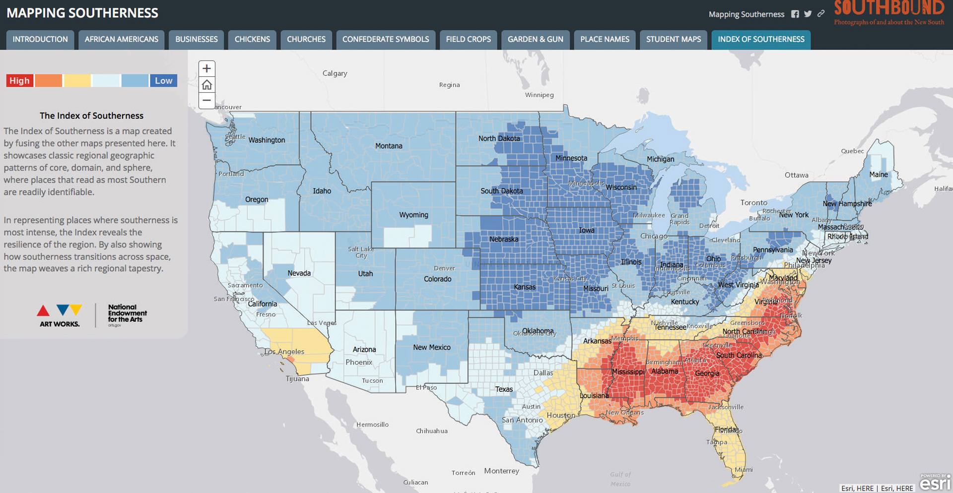
Bunch contributed maps for the exhibition and book, and also created the project’s website. Using Geographic Information System (GIS) mapping software and publicly available datasets from various census bureaus, Bunch created his “Index of Southerness” maps based on hundreds of millions of data points that are used to analyze the prevalence of street names, reading habits, business names, field crops, churches, and place names that reference the culture and history of the South.
For more information, including the traveling exhibition schedule, visit southboundproject.org
Story by Matthew Bryant